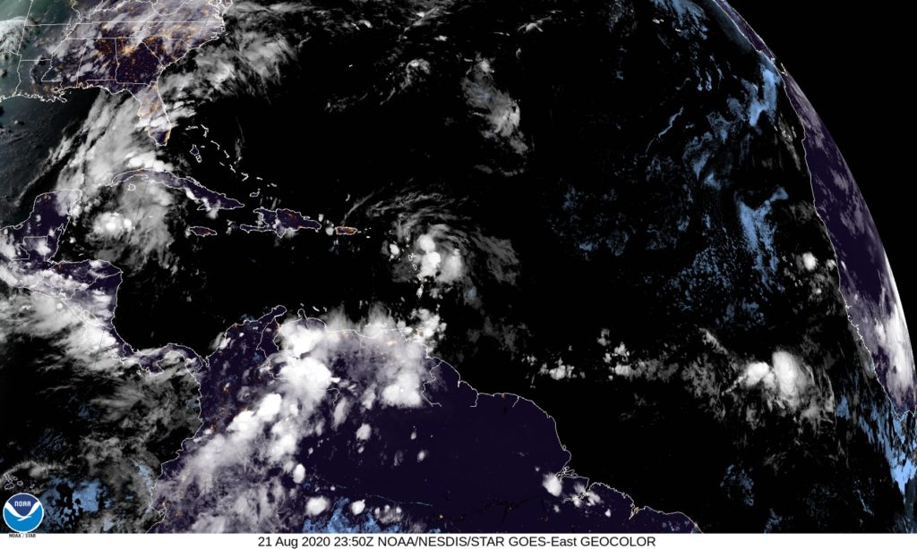
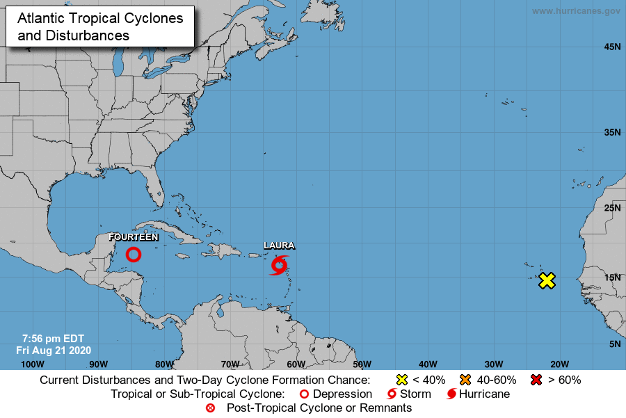
We are nearing the peak of the Atlantic hurricane season, and we are tracking two systems. Both systems are expected to impact the United States next week, possibly as hurricanes.

After a short break in the tropics, Tropical Storm Laura and Tropical Depression 14 have developed in the Atlantic Ocean, and there is a chance that both storms may impact the United States next week.

Tropical Storm Laura
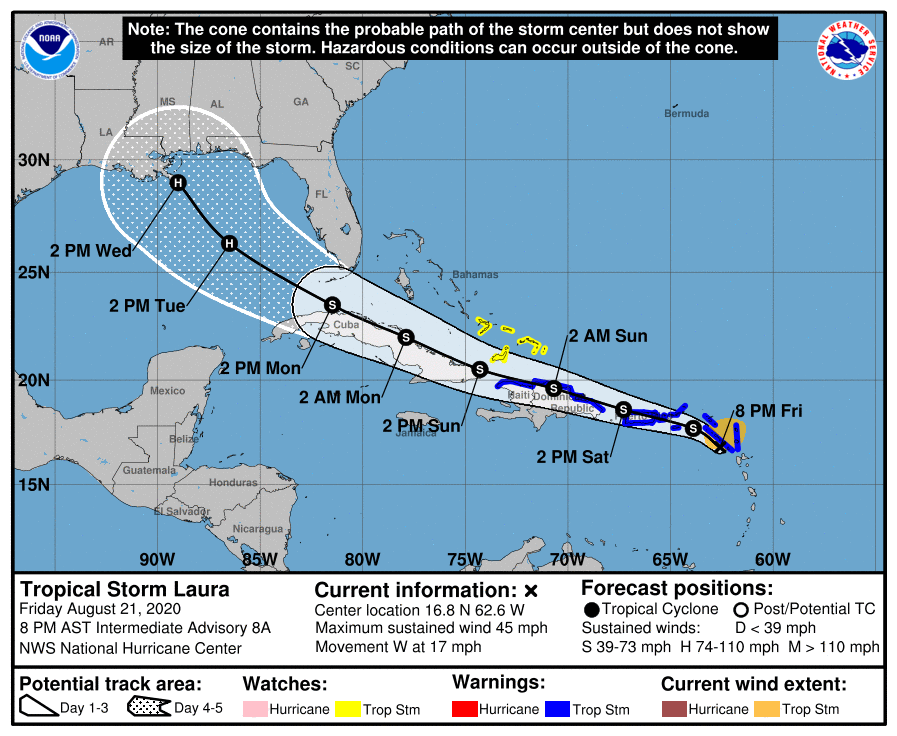
Let’s focus on Tropical Storm Laura first. Tropical Storm Laura is currently impacting the Leeward Islands and is quickly moving towards Puerto Rico, the Dominican Republic, and Haiti. Laura is expected to track across Puerto Rico tomorrow and impact Hispaniola on Saturday evening and Sunday morning as a tropical storm.

The current NHC track keeps Laura a Tropical Storm has it moves near Cuba on Sunday. By Monday morning, the Florida keys and the Florida Peninsula are expected to be receiving impacts from Tropical Storm Laura. Now would be the time to begin making plans for a tropical storm across the southern portions of Florida. Greatest threats would be tropical storm winds, heavy rain, and storm surge. Laura is expected to move into the Gulf of Mexico, and that is where the uncertainty with the track begins. A few factors will determine where Laura tracks, including where Tropical Depression 14 tracks, the position of the Bermuda High, and the location of an upper level trough.
Tropical Depression 14
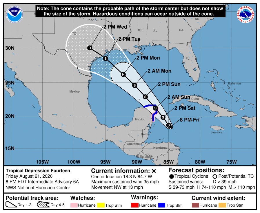
Tropical Depression 14 is expected to strengthen into Tropical Storm Marco tonight. The storm is expected to make landfall near the Yucatan Peninsula late Saturday, possibly as a weak hurricane with winds of 75 mph. As it moves across the Yucatan, TD14 is expected to weaken before emerging into the Gulf of Mexico. The current track brings TD14 (Marco) towards the Texas coastline on Tuesday and Wednesday as a strong tropical storm.

If Laura and Marco are both in the Gulf of Mexico at the same time, it would be the first time since 1959 that two tropical systems were in the Gulf of Mexico at the same time. It is important for everyone along the Gulf Coast from Florida to Texas to begin making plans for Laura and Marco.
For us in the Carolinas, it is possible that we may receive rainfall from Laura, depending on the track. It really depends on how Laura interacts with the Bermuda high and an upper level trough over the southeast. Marco looks to move into Texas before raining itself out, so any affects from Marco would be indirect.
